Continuing with a nautical theme, here is a nautical chart I creating using QGIS 2.4. It includes a Graticule in decimal degrees, a Compass Rose and a scale bar in Nautical Miles. A magnetic declination of 3º 35′ was determined using the MagneticField utility of GeographicLib, an advanced software library for solving geodesic problems. I will post a full tutorial shortly.
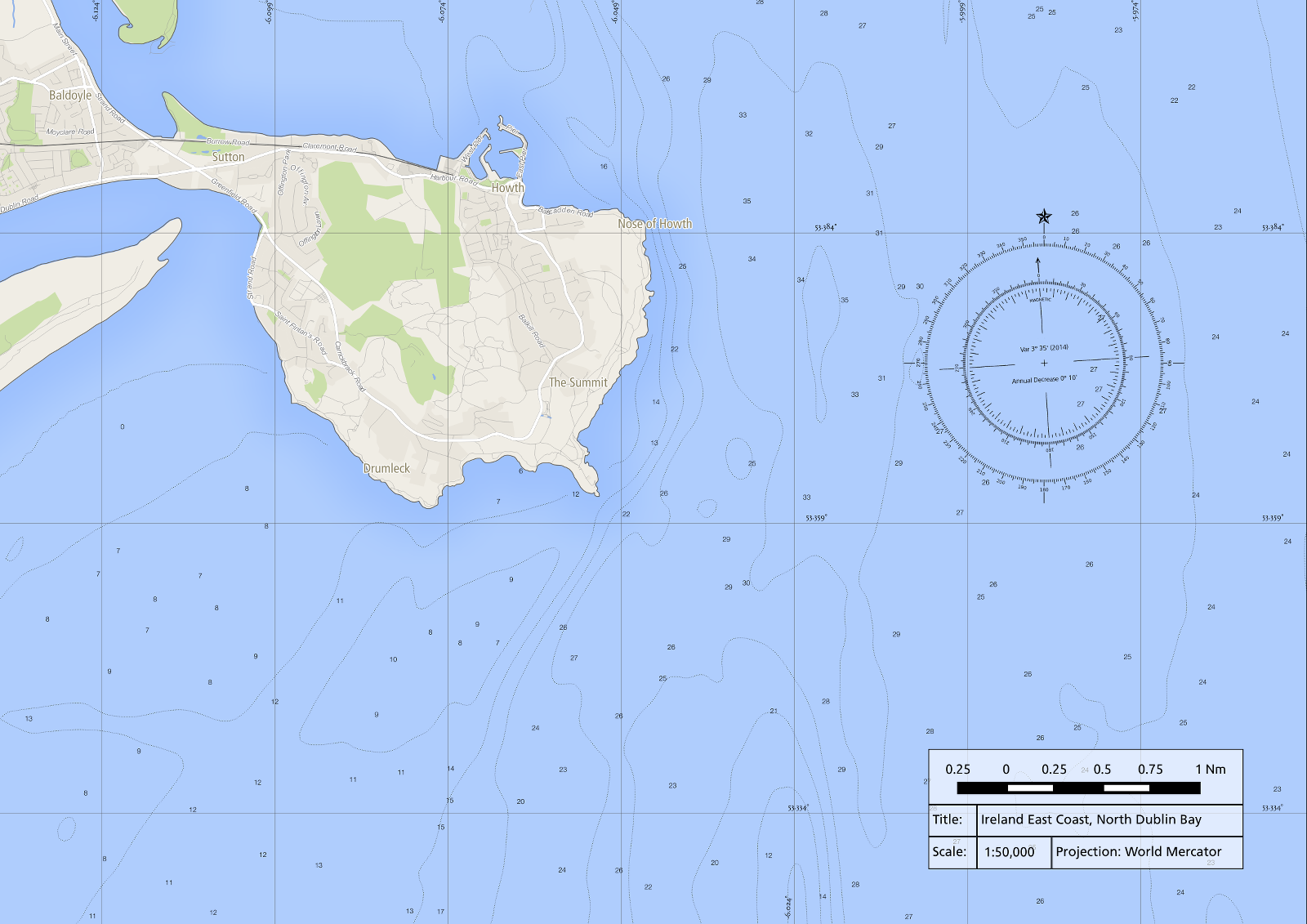
Nautical Chart for North Dublin Bay

Nautical maps are usually in Mercator projection.
Question : what about the depth lines ?
It is a work in progress, I still have to apply a proper map projection and obtain bathymetric data. There’s excellent bathymetric data for Dublin Bay from INFOMAR, I’ll add contours and depth points to the map.